Thursday, November 2, 2017

May-October (wildfire season) summary for Fort Collins

The wildfire season has come to a close, so I thought I would just give a quick overview of the summer air quality as it pertains to PM2.5.

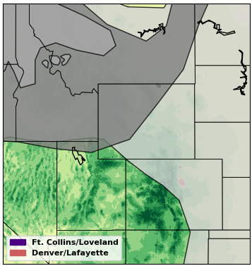
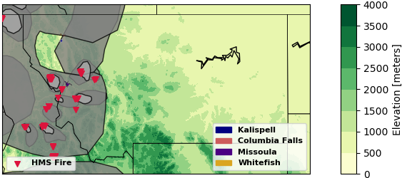
We had several days of smoke this season, with very little of it being from local fires.  The following is a map of the CONUS showing the number of days with HMS smoke plumes from May-October 2017.
Number of days with an HMS smoke plume for the period of May 1st - October 31st, 2017. Data from satepsanone.nesdis.noaa.gov.
We obviously did not experience as many smoke days as the Northwest, but Fort Collins still had a significant number of days where the HMS product noted smoke compared to previous years. According to the HMS product, there were 41 days when smoke was noted over Fort Collins (2016 had 30; 2015 had 23; 2014 had 21; 2013 had 34; and 2012 had 69 days).

The maximum hourly concentration at the Fort Collins site was 106 ug/m3 and the maximum daily concentration was 60 ug/m3. (as a note, all PM data I show on this sites is from the real-time reports and have not been corrected or validated, meaning that these values may change). Both of these occurred on Labor Day (4th of September). You can read the blog post on that event here. This was the only day where the 24-hr concentration was greater than the EPA's standard of 35 ug/m3. However, as this was due to transported wildfire smoke, it will likely be classified as an exceptional event (which means it will be excluded when determining attainment status). Below is the time series of the 24-hour average PM2.5 concentrations in Fort Collins.

Time series of PM2.5 concentrations in Fort Collins, CO from May through October 2017. Data from https://www.colorado.gov/airquality/.
You can see from the time series that our air quality (as it pertains to particulate matter) is generally pretty good here in Fort Collins. Most of the days with elevated PM2.5 concentrations had smoke present. Earlier in the season (May and June), we had a few high PM days which we can't specifically attribute to smoke because the satellites do not clearly show plumes over Fort Collins. However, there were lots of fires in Mexico, Arizona, Utah, and New Mexico that were producing large smoke plumes. It is feasible that we got a little of that smoke here but that the plumes were much more diluted by the time they reached us so as not to be as distinct in the satellite images. There's also the possibility that these were due to more local sources as other monitoring sites in Colorado did not see the same PM increases. One exception would be June 27th. The HMS plumes did not extend as far north as Fort Collins, but all of the sites around Colorado did show increases in PM2.5 concentrations, and the HMS product did show smoke from a fire in Utah transported over all of Colorado on the 28th (we weren't on top of our blogging game during that event).

Some side thoughts: Environmental regulations have really helped improve air quality overall in the US. We have seen decreases in anthropogenic (meaning from human activity) emissions that have led to better "average" air quality. However, at the same time, we've also had lots more large wildfires that have produced extremely poor air quality for much of the western US. Reducing wildfire emissions is obviously difficult as it means stopping large wildfires before they start (land management, prescribed burns, people being more responsible, etc.). Thus, wildfire smoke is becoming an increasing health concern as it could be offsetting some of the air quality benefits gained from reductions in other emission sources. Know how to protect your health during smoke events and stay aware of current  air quality conditions!

Wednesday, October 18, 2017

Smoke from prescribed fire on October 17, 2017

I have been testing AOD (aerosol optical depth, a measure of light extinction due to aerosols in the atmosphere) devices this week. As such, I've been comparing results with nearby AERONET sites (https://aeronet.gsfc.nasa.gov/). I was looking at the NEON_CVALLA site and noticed this weird spike in AOD in the afternoon yesterday (October 17th). I checked the other sites and saw spikes at the NEON_RMNP site, Table Mountain site, and high values at the Digital Globe calibration site. These are all Level 1 products, so they may not pass quality checks, but I still thought it was strange and warranted further investigation.
Level 1 AOD from NEON_CVALLA site on 17th October 2017. Image from: https://aeronet.gsfc.nasa.gov/cgi-bin/type_one_station_opera_v2_new?site=NEON_CVALLA 
I checked HMS, and I noticed some fires near Fort Collins, which I assumed were probably prescribed fires since they aren't there today. Zooming in, I more clearly saw that there was indeed some smoke produced from the fires.

HMS Smoke and Fire product for October 17th, 2017 over the whole western US (left) and zoomed in over northern Colorado (right). Data from: satepsanone.nesdis.noaa.gov.

I double-checked this against MODIS. There was no smoke noted from the Terra instrument (which has a morning overpass), but there was smoke visible from the Aqua instrument (which has an afternoon overpass).
MODIS True Color Images from Terra (left) and Aqua (right) for October 17th, 2017.

I checked if there was any impact on our surface air quality, and there was a slight increase in PM2.5. Coarse PM (2.5-10) also increased. The timing seems earlier than what was noted by the satellites, but the satellites may have not picked it up in the morning and the smoke may have not made it to the AERONET sites until later in the day. There is also a diurnal cycle to the PM time series where concentrations are higher in the morning and night, and low during the day. This could be from the boundary layer trapping concentrations near the surface. Then, as the boundary layer grew throughout the day, concentrations decreased. It's hard to untangle all of this and directly attribute both the PM changes in Fort Collins and the AOD spikes at AERONET sites further downwind to this smoke, but it seems to be at least a plausible source.
PM2.5 and Coarse PM concentrations measured in Fort Collins, CO for October 16-18th, 2017.

Another double-check that this was indeed a prescribed fire sent me to InciWeb (where all fire incidents are recorded), where I found that the smoke was likely from the Pingree Hill Prescribed Burn (https://inciweb.nwcg.gov/incident/4727/) as its location generally matched the location from the satellite data. They burned 95 acres yesterday.

Friday, October 13, 2017

More transported smoke from the west October 12-13, 2017

If you've been following the news, you'll have likely heard about the terrible wildfires raging in California. Many people have died, homes and businesses have been destroyed, and some of the worst air quality on record has been measured. The strong dry winds are not helping the situation, and many people have been evacuated as the fires continue to spread. This has been a long fire season. I was getting ready to write a summary of the season (which I will post soon), but we are getting more smoke now in Fort Collins.

I noticed the smoke as I was leaving work last night (October 12th*), and I snapped this picture (getting use to my solar field pictures yet?). It looked hazy again today (October 13th).
Looking north northwest from the CSU Atmospheric Science building at 5:08 PM MT on 12 October 2017.

CDPHE had this Colorado Smoke Outlook today (October 13th):

COLORADO SMOKE OUTLOOK:
Friday, October 13, 2017, 8:05 AM MDT

Wildfire smoke is being transported into Colorado from fires burning in the western United States. Impacts from this smoke are most likely along the Northern Colorado Front range and for locations east of the Continental Divide, however hazy and smoky skies may be noticed throughout the state. No significant impacts on public health are expected. 

Where is this smoke from?
Trying to determine the source of the smoke, I turned to the satellite images. The source hasn't been as clear to me because the plumes are not as distinct. The MODIS-Terra images did look like there was some smoke over Wyoming and Utah earlier in the day yesterday.
MODIS-Terra True Color Image from October 12th, 2017. Retrieved from https://worldview.earthdata.nasa.gov/. The line is from the two different overpasses being put together. 
The HMS smoke product seems to agree, showing plumes stretching over Utah, Wyoming, and NW Colorado both on October 12th and October 13th that could have hit us in Fort Collins as well. There was also a prescribed fire near Denver, a wildfire in Utah, and some prescribed fires in SE Idaho. Some of the smoke forecast models (Bluesky and HRRR) seemed to suggest that some of the smoke in Colorado could be from those sources as well. However, these do not show up in the satellite images, so I would wager a guess that this smoke is mostly from fires in California.
HMS smoke and fire product for 12 October 2017. Data from satepsanone.nesdis.noaa.gov.

What was the impact on our surface air quality?

You can notice the higher concentrations in the measured PM2.5 in Fort Collins. The increase started right around the time that I was leaving work on Thursday, October 12th.

PM2.5 measured in Fort Collins, CO for October 10-13, 2017. Data from https://www.colorado.gov/airquality/.


*Originally posted October 13th, updated October 17th, 2017.


Tuesday, September 5, 2017

Labor day, a holiday up in smoke

I have been working on blog posts, but it seems like we have been getting smoke more often than I can find time to write about it! However, yesterday's smoke was the worst that we've had all summer, so I felt compelled to sit down and write out the post. Warning, this is a pretty long post. We had a whole holiday weekend full of smoke, with concentrations hitting 30 and 40 ug/m3 on Saturday and Sunday, and it all seemed to stick around and build up overnight on Sunday.

When I woke up Monday morning, it was so dark and hazy. I checked the PM2.5 concentrations, and I was pretty surprised how high the concentrations were for not having a fire nearby. Concentrations were over 100 ug/m3 overnight (shown in time series below)! In the following plot, I am showing you a longer time series than I usual do, so that you can see normal summertime concentrations (August 24/25), the slightly smoky days like we've been seeing a lot of this summer (August 29-31), and then this event from the past weekend.
Time series of PM2.5 concentrations measured in Fort Collins (blue) and Greeley (orange) for August 22 through September 5, 2017 (dashed lines indicate start of new day). Data from https://www.colorado.gov/airquality/
I went out and took the following pictures in my neighborhood in Laporte.
Looking east (left) and west (right) from Laporte at 7:45 AM on September 4, 2017.
The CDPHE released this advisory Monday morning:
Air Quality Health Advisory for Wildfire Smoke
Issued for areas below 7000 ft. in eastern ColoradoIssued at 9:30 AM MDT, Monday, September 4, 2017 
Issued by the Colorado Department of Public Health and Environment 
Affected Area:  Areas below 7000 ft. in eastern Colorado.  Locations include, but are not limited to Denver, Boulder, Ft. Collins, Greeley, Colorado Springs, Pueblo, Ft Morgan, Sterling, Julesburg, Holyoke, Boulder, Broomfield, Brighton, Littleton, Akron, Wray, Castle Rock, Kiowa, Hugo, Burlington, Cheyenne Wells, Ordway, Eads, La Junta, Las Animas, Lamar, Trinidad and Springfield.
Advisory in Effect: 9:30 AM MDT, Monday, September 4, 2017 to 9:00 AM MDT, Tuesday, September 5, 2017
Public Health Recommendations: If smoke is thick or becomes thick in your neighborhood you may want to remain indoors.  This is especially true for those with heart disease, respiratory illnesses, the very young, and the elderly.  Consider limiting outdoor activity when moderate to heavy smoke is present.  Consider relocating temporarily if smoke is present indoors and is making you ill.  If visibility is less than 5 miles in smoke in your neighborhood, smoke has reached levels that are unhealthy.
Outlook:  Moderate to heavy smoke from fires in the northwestern US and western Canada is being transported into eastern Colorado.  Smoke will slowly decrease Monday afternoon and evening, however due to the lingering health impacts of fine particulate concentrations we urge the public to continue to follow the health recommendations listed above through at least Tuesday morning.

My co-workers and I started trying to figure out where the smoke was originating. The HMS fire product showed that there was a fire west of Fort Collins near Walden, CO, but the satellite images seemed to show this smoke was coming from the north.
HMS smoke and fire products for 4 September 2017 in the AM (left) and PM (right).
You can really see all the smoke from Idaho and Montana in this image from the GOES-16 satellite released by the NWS. We were all looking at the GOES-16 loops and were pretty mesmerizedd by the smoke transport (you can look at the latest ones here: http://whirlwind.aos.wisc.edu/~wxp/goes16/vis_color_enh/goes16_conus_3h.html).
We had planned to go to Horsetooth Reservoir, but when we got there, it was pretty smoky as shown in the following pictures (comparing June 4, 2017 to August 4, 2017). We only lasted about 45 minutes before our eyes were itchy, and our throats were scratchy.
Looking south/southeast from North Bay at Horsetooth Reservoir on June 4, 2017 (left) and September 4, 2017 (right).
From the advisory, you can note that many areas of the state were impacted by the smoke. I plotted up concentrations from two of the monitoring stations in Denver, there's a pretty similar pattern to the concentrations measured in Fort Collins and Greeley. However, concentrations did not get as high, and the timing of the peak concentration in the afternoon was a couple hours later.
Time series of PM2.5 concentrations measured at two Denver sites: La Casa (blue) and CAMP (orange) for August 22 through September 5, 2017 (dashed lines indicate start of new day). Data from https://www.colorado.gov/airquality/
These are images of Denver comparing September 4th (at 4 PM) of 2016 to 2017. Pretty big difference!
Image of Denver at 4 PM on September 4th 2016 (left) and 2017 (right). From https://www.colorado.gov/airquality/live_image.aspx.
Thankfully, concentrations went down today. They are still above "normal" (as you can see from the time series above) but now that we are back sitting in the office, the air outside is much better for outdoor activities. Hope you found some good indoor activities yesterday!


Monday, August 21, 2017

Smoke on the Eclipse

Hopefully, lots of you got out to enjoy the eclipse today. As we were watching the eclipse from our Atmospheric Science campus in Fort Collins, we were looking around at how much the sunlight was dimmed. We saw that there was definitely some smoke visible to the north as shown in the following pictures. The second photo was taken during the maximum eclipse time here.

Looking north from the Atmospheric Science Building in Fort Collins, CO at 11:16 AM and 11:46 PM.

 The Colorado Department of Public Health had this smoke advisory out (https://www.colorado.gov/airquality/colo_smoke.aspx):
COLORADO SMOKE OUTLOOK:
Monday, August 21, 2017, 2:30 PM MDT

Smoke from wildfires in the northwest United States and western Canada is being transported into Colorado. The influence of this smoke is expected to produce areas of haze, particularly in northern Colorado, however these conditions are possible throughout the state. Significant health impacts are not anticipated, however, unusually sensitive people should consider reducing prolonged or heavy exertion on Monday and Tuesday. 

Light to moderate smoke is also possible near prescribed fires and small wildfires around the state. 

Unfortunately, the Fort Collins PM monitor does not appear to have any data available since Saturday morning, so I cannot tell you what the impact is on surface air quality here in Fort Collins. The Greeley monitor does show PM concentrations that were elevated (especially overnight), but there's been lots of variability, so it's difficult to tell if wildfire smoke is the culprit.
PM2.5 concentrations at the Greeley Hospital for 18th August- 21st August, 2017. Data from: https://www.colorado.gov/airquality/.
And this is what the MODIS satellite image looked like (the overpass was right during the eclipse!):
MODIS Terra True Color Image from August 21st, 2017. Retrieved from  https://worldview.earthdata.nasa.gov.
But, never fear, we can still look to the HMS product! The HMS smoke and fire product did show that we are getting some smoke from fires in the Pacific Northwest. The plume seems to be covering much of northern Colorado, so it could definitely be influencing the surface air quality!


Again, happy "eclipse of the century" day. Hope you enjoyed it and kept your eyes safe!

Monday, August 14, 2017

Smoke in Fort Collins August 8-11, 2017

It was cloudy and rainy a lot last week, so you may not have noticed all the wildfire smoke in the air. Since I work near the foothills, I can use them as a quick visibility reference. On Tuesday (August 8th), they were definitely looking a little hazy (as you can see in the picture below), and I got several messages asking if it was smoke.

Looking northwest from CSU Atmospheric Science Campus August 8, 2017 at 5:30 PM. 

We checked and noticed that PM2.5 concentrations were elevated that day, peaking around 25 ug/m3.

Hourly PM2.5 concentraions at CSU Facilities for August 8th - August 12th, 2017. Data taken from https://www.colorado.gov/airquality/.

As you can see from the HMS below, we were getting smoke from the Northwest pretty much all week. I noticed haziness again on Friday and took this picture from the roof of the Atmospheric Science building (out on Laporte Ave in west Fort Collins) looking north. Comparing this to the time series, we can see that concentrations had actually decreased from earlier that morning when they had built up to 17 ug/m3

Looking north from the Atmospheric Science building in west Fort Collins at 1:30 PM on Friday, August 11, 2017.

The smoke plumes seemed to be moving around and over us a lot up here in Fort Collins, but the smoke seemed to not make it down to Denver as often. Thankfully, concentrations in Fort Collins did not get as high as on Tuesday for the rest of the week, and you can also that the afternoon rains kept helping clear the air. It was not until Friday evening when I saw another cool, really red sunset (unfortunately all my pictures were pretty blurry). There were some local fires on August 10th, but they did not seem to produce smoke plumes that stood out in the HMS product from the smoke transported from the Northwest.

HMS Smoke Products August 8th AM, August 8th PM, August 9th AM, August 9th PM, August 10th AM, August 10th PM, August 11th AM, and August 11th PM. 

Looks like the smoke is skirting past us today (Monday, August 14th), but we will see what the rest of the week holds!

Thursday, August 10, 2017

Smoke in Colorado August 1-4, 2017

While I was in Montana (which was completely blanketed in smoke the whole time I was there), Colorado also got some wildfire smoke. There are lots of fires in BC, WA, ID, and MT, so it is difficult to tell exactly where all the smoke came from originally. However, it got here and did degrade the air quality in Fort Collins. You are probably noticing an overall theme, which is that most of our significant particulate pollution events are due to wildfires, both from local and distant fires. Thus, most of these blog posts are about wildfire smoke. Unfortunately, I do not have any cool sunset pictures as I was away last week, but I will show what the impact was on our PM2.5 concentrations and the satellite view of smoke over northern Colorado.

We can see from the time series above that PM2.5 concentrations were slightly elevated on August 1st - August 4th, which does correspond to smoke over the area as shown in the plots below. There was a lot of variability as the wind shifted smoke plumes around. Another thing to remember when comparing the time series to the plots below, is that these smoke plumes are determined from satellite images. Satellites see the whole atmosphere and not just the surface. Satellites "see" smoke over northern Colorado on many days when there is no corresponding increase in surface PM2.5 concentrations. Sometimes smoke can be lofted above our heads (especially when it has been transported a long way); visibility may be impacted but not necessarily our health.

HMS Smoke Plumes over northern Colorado on August 1st AM, August 1st PM, August 2nd AM, August 3rd AM, August 4th AM, and August 4th PM. 

You could also see the smoke in the MODIS (true color) satellite image over Colorado on August 2nd and 4th. The bright white is cloud and the gray "wisps" are smoke. You can probably see why it might have been difficult for someone on the ground to tell smoke from the clouds with it all layered together!

MODIS Terra true color image from August 2nd and August 4th, 2017. Retrieved from https://worldview.earthdata.nasa.gov.

Monday, August 7, 2017

A Montana Vacation in Smoke

So, a little background on me: I was born in Montana and still have family up there. My husband and I love it up in the Flathead Valley (near Glacier) and try to vacation there often. So, we decided to spend a week visiting friends and family before the semester starts back up.

Looking northwest from Main Street in Kalispell (technically, Sweet Peaks) on Tuesday, August 1st at 9 PM. The super red sunset was from all the smoke in the air.

Unfortunately, Montana has been really hot and dry this summer, and there are wildfire everywhere. Since smoke exposure is bad for your health, we didn't hike or camp like we were planning. We still had an amazing time and saw some sweet sunsets (see pic above), but the smoke is a sad situation and definitely reduced the visibility of all the beautiful scenery (see pic below). Another problem is that it isn't usually hot for so long, so a lot of people don't have air conditioning, and the smoke makes it indoors.
Looking north from Columbia Falls at Whitefish Mountain on (left) Tuesday, August 1 at 11 AM,  (middle) Thursday, August 3 at 6 PM, and (right) Saturday, August 5 at 10:30 AM. The mountains kept appearing and disappearing!

So, I'll give you an idea of the conditions there. Most of the fires are in western  Montana, around Missoula (although by the end of the week, we were getting smoke from Idaho, Washington, and British Columbia as well). We drove up through Seeley Lake on Saturday, July 30, 2017. It smelled like smoke and my eyes were burning. The Rice Ridge Fire (https://inciweb.nwcg.gov/incident/5414/) was burning just west of Seeley Lake. They were on mandatory evacuation watch all last week, the lake was closed for recreational activities, and lot of the hiking trails were completely closed. It is still only 10% contained. Probably didn't help that they had to suspend aerial firefighting last week on Wednesday because someone was flying a drone.

HMS Smoke Plumes and Fires for July 30th, July 31st, August 1st AM, August 1st PM, August 2nd, August 3rd AM, and August 3rd PM.

Concentrations definitely reached the unhealthy level for many towns in Montana. From the HMS plots, you can see smoke covering most of the state pretty much everyday of our vacation. It smelled like a campfire outside a lot of the time. I took allergy medicine everyday and had pretty itchy eyes. I had filled my inhaler prescription before I left, but luckily, I didn't have to use it (probably because we didn't do any vigorous outdoor activity). Anyway, here were the concentrations in the Flathead Valley, not nearly as high as down in Seeley Lake or other towns south of where we were (Columbia Falls/Whitefish/Kalispell), but still much above normal.

PM2.5 concentrations recorded for the Flathead Valley monitor for July 30 through August 4, 2017. Data from http://svc.mt.gov/deq/todaysair/.